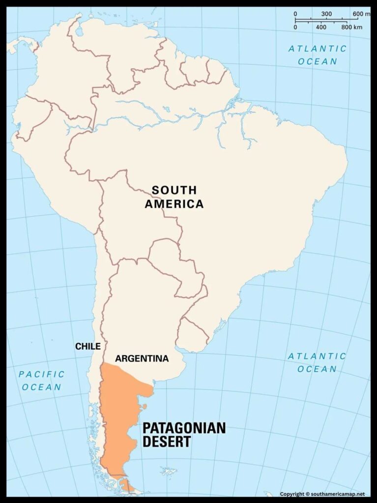
Patagonia South America Map – Patagonia is a vast and sparsely populated region at the southern tip of South America, encompassing parts of both Argentina and Chile. This stunning and remote area is characterized by its dramatic landscapes, including rugged mountains, expansive plains, glaciers, and pristine lakes. The Argentine portion of Patagonia extends southward from the Colorado River to Tierra del Fuego, while the Chilean part stretches from the Biobío River to the southern tip of the continent.
Related Post –
- South America Map with Capitals
- Peru Map
- Amazon River Map
- Map of South America Countries
- Political Map
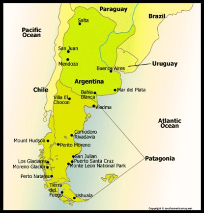
Patagonia South America Map
The Andes mountain range dominates the western edge of Patagonia, creating a breathtaking backdrop of snow-capped peaks and deep fjords. Glaciers, such as the renowned Perito Moreno Glacier in Argentina, contribute to the region’s unique charm. The eastern plains, known as the Patagonian Steppe, feature vast grasslands dotted with isolated mesas and unique wildlife like guanacos and rheas.
Patagonia is a haven for outdoor enthusiasts, offering opportunities for trekking, mountaineering, and exploring pristine national parks. Torres del Paine National Park in Chile and Los Glaciares National Park in Argentina are iconic destinations within Patagonia, showcasing the region’s natural wonders.
Despite its harsh climate and remoteness, Patagonia has a rich cultural history shaped by indigenous communities, European colonization, and a blend of influences. The region’s unique identity is reflected in its folklore, traditions, and the resilience of its people against the challenges of the harsh environment. Patagonia, with its raw beauty and untouched wilderness, continues to attract adventurers seeking an immersive experience in one of the world’s most captivating landscapes.
Where is Patagonia on the Map of South America
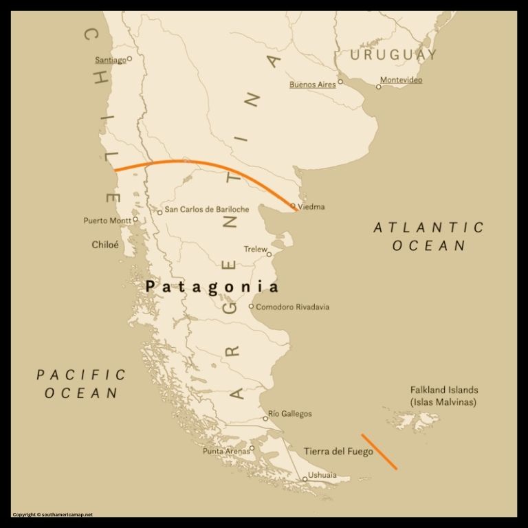
Patagonia stretches across the southern tip of South America, encompassing the southernmost portions of Argentina and Chile. It roughly spans from the 35th to 56th parallel south, extending from the wind-swept plains of southern Mendoza and Neuquen provinces in Argentina, south along the Andes Mountains, and eventually splitting into two distinct sections:
- Argentinian Patagonia: Known for its glacial lakes, arid steppes, and dramatic coastline, it occupies the eastern side of the Andes.
- Chilean Patagonia: Characterized by lush forests, rugged fjords, and towering mountains, it lies on the western side of the Andes.
Here’s a breakdown of its location in more detail:
- North: Bordered by the provinces of Rio Negro and Chubut in Argentina.
- South: Extends to the southern tip of South America, with Tierra del Fuego at its southernmost point.
- East: Bordered by the Atlantic Ocean.
- West: Bordered by the Chilean Patagonia and the Pacific Ocean.
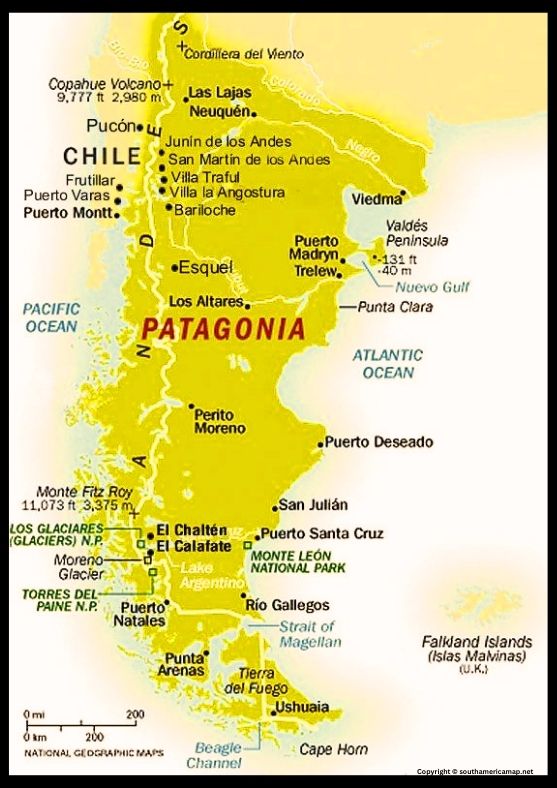
Patagonia South America on Map
A map of Patagonia in South America serves as a valuable tool for various purposes, including:
1. Education and Exploration:
- Visualizing the region: A labeled map provides a clear picture of Patagonia’s location within South America, its borders, major cities, natural features (Andes Mountains, Torres del Paine National Park, Perito Moreno Glacier, etc.), and bodies of water (Atlantic Ocean, Strait of Magellan, etc.). This visualization aids in learning about Patagonia’s geography and its diverse landscapes.
- Planning adventures: For those seeking to trek through the Patagonian wilderness, navigate the intricate fjords, or visit remote villages, a map is indispensable for planning routes, identifying landmarks, and ensuring safe navigation.
- Facilitating research: Whether researching unique wildlife species like penguins and guanacos, exploring historical sites like Punta Arenas, or studying diverse ecosystems like the Andean forests, a map helps locate specific areas of interest and gather necessary information.
2. Navigation and Travel:
- Plotting routes: Whether embarking on a multi-day hike through Torres del Paine, a scenic drive along the Carretera Austral, or a boat tour through the Beagle Channel, a detailed map allows for efficient route planning and avoids getting lost in the vastness of Patagonia.
- Understanding distances and transportation: Labels on the map indicate distances between cities and towns, routes of buses, ferries, and even trekking trails. This information helps plan travel itineraries and understand transportation options within the region.
- Locating specific destinations: With labels identifying cities, towns, national parks, and natural wonders, a map allows travelers to easily find their desired locations and navigate with confidence.
Map of South America Showing Patagonia
- Discovering diverse cultures: Patagonia boasts a rich cultural heritage, including indigenous communities like the Mapuche, European settlers, and contemporary artists and musicians. A map helps identify areas with distinct traditions and languages, fostering understanding and appreciation for the region’s cultural tapestry.
- Understanding historical context: Labels can highlight historical sites like the Estancia Harberton, the Magallanes Fort, and shipwrecks from early explorers, providing context for understanding Patagonia’s history and its connection to European exploration.
- Appreciating natural wonders: Labels highlighting Torres del Paine, the Perito Moreno Glacier, Tierra del Fuego, and the Valdes Peninsula inspire wonder and appreciation for Patagonia’s unique ecosystems and biodiversity.
4. Tourism and Development:
- Creating travel brochures: Detailed maps with highlighted attractions, routes, and landmarks can be used to create informative tourist brochures, attracting visitors to Patagonia and boosting the tourism industry.
- Planning infrastructure projects: Maps are crucial for planning and executing infrastructure projects like roads, airports, and accommodation facilities, which are essential for tourism development and supporting the growing number of visitors.
- Promoting sustainable practices: By identifying areas sensitive to environmental changes, a map can help promote sustainable tourism practices and protect Patagonia’s natural beauty for future generations.